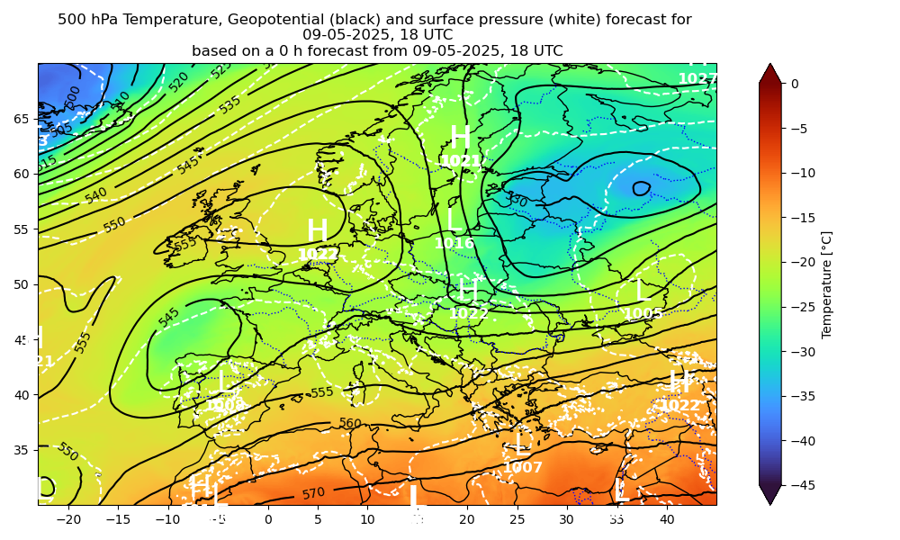
These pages contain maps of the ICON forecasting system for Europe.
The data for theses charts is freely available at opendata.dwd.de.
All 6 hours the model simulations are updated, but the forecasting maps have a delay of approximately 4 hours.
You can either select four panels of the same quantity or a forecast overview with four panels of different variables, using the menu on the left at the item "Forecast Maps". You can enlarge the individual panels by clicking on the pictures.